
Everything you need to warn and inform.
Multi-hazard early warning capabilities delivered through one unified cloud GIS workspace. Every module connects to your live map, helping inform communities and manage incidents through to resolution.
multiple modules · one platform · same map
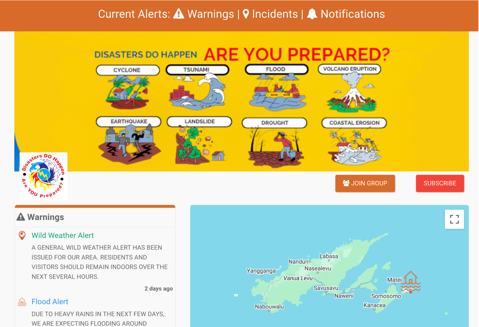
Alert & Incident Map
A configurable GIS canvas authorised teams use to publish location-pinned warnings and incidents — embeddable in any website with a snippet of code.
- Customisable map layers and base maps
- Drop-in widget for any agency website
- Direct posting to social channels
- Open QR access for posters and signage
- GIS-grade accuracy without GIS expertise
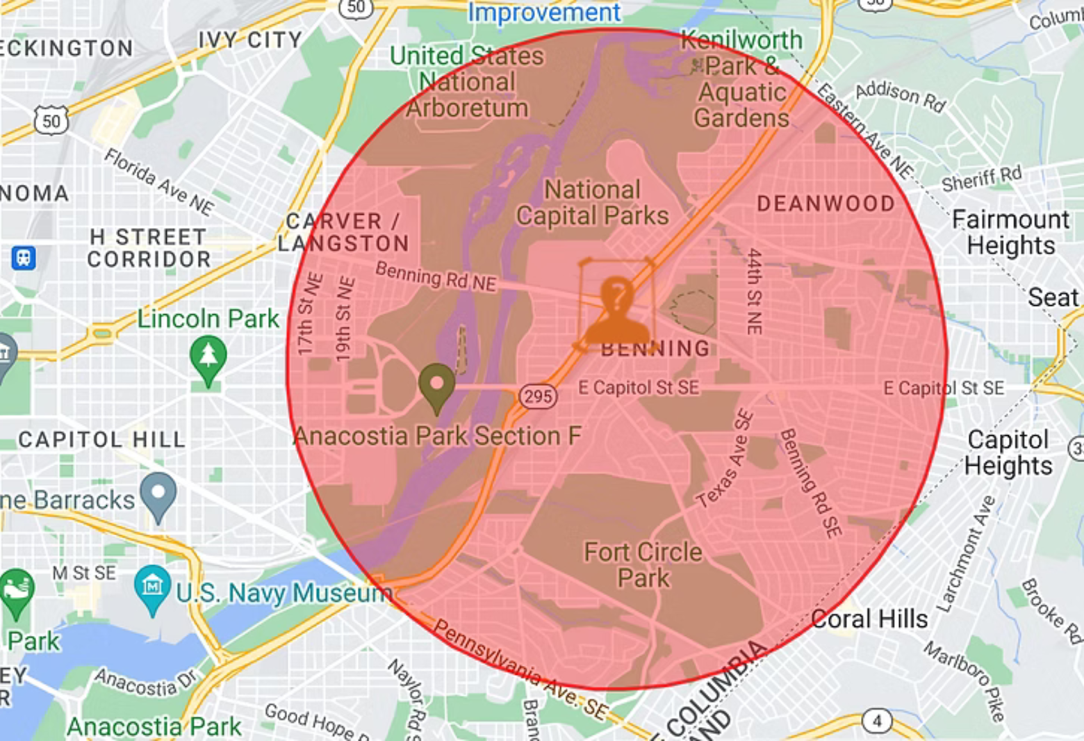
Geofence Alerts
Trigger localised alerts the moment someone enters or approaches a defined zone — relevant to where the user actually is, not where they live.
- Draw zones at any scale, from a building to a region
- Proximity-aware delivery to nearby devices
- Live status escalation as situations change
- End-to-end ownership of the alert lifecycle
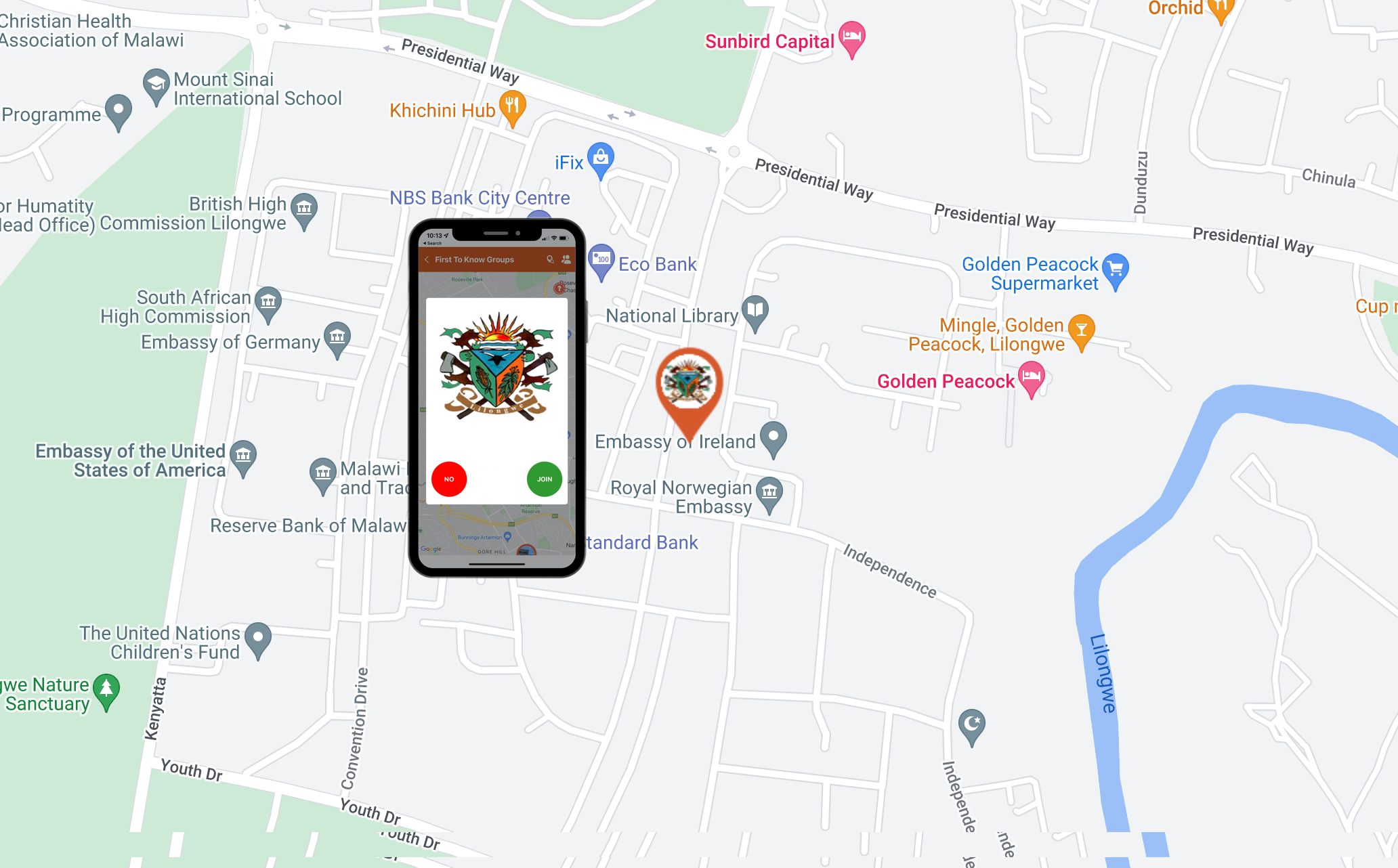
First to Know Groups
Create First to Know groups for neighbourhoods, municipalities, schools, hospitals, places of worship, workplaces, and communities. Groups are curated directly on the map and can be joined anonymously with a single click.
- Unlimited groups, unlimited alerts
- No app install, no account, no PII
- Anonymous two-way feedback
- Per-group permissions and audit
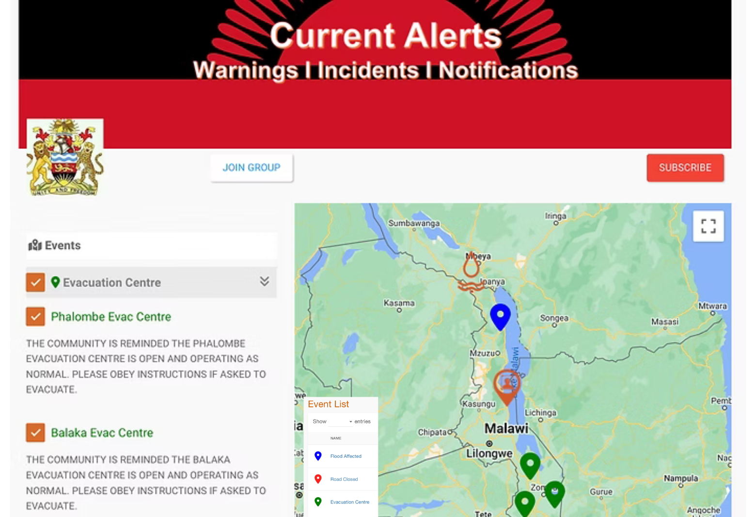
Event Layers
Custom GIS overlays that track an unfolding event — flood lines, road closures, evacuation corridors — updated by your team in real time.
- Build a layer for any incident type
- Edit live as the situation evolves
- Public read access without sign-in
- Trend timelines for after-action review
Geo Surveys
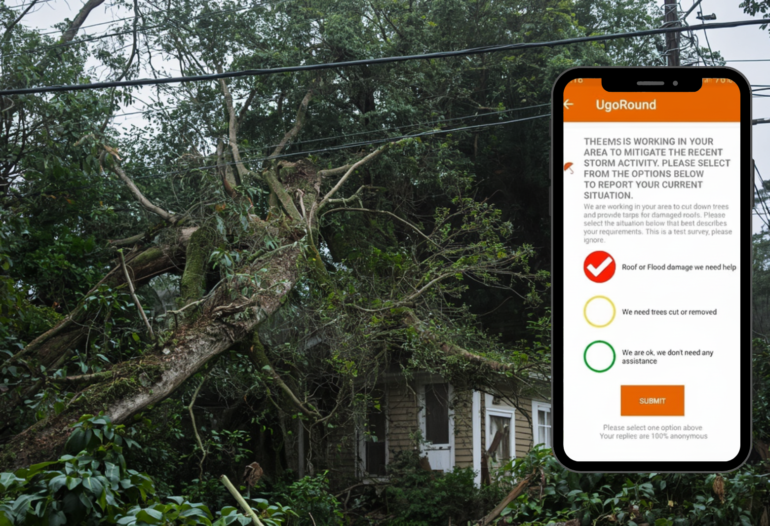
Anonymous, location-tagged polls that turn community input into a heat map of sentiment, need, and emerging issues.
- Anonymous responses with location context
- Map-first results visualisation
- Targeted resource deployment
- Cross-incident comparison and history
Incidents & Field Reports
Plot incidents the moment they're observed and promote them straight into a public alert when they cross a threshold.
- Pin incidents from the field on web or mobile
- One-tap escalation to public alert
- Earlier community awareness
- Reportable workflow for line staff
Rating & Feedback
Every alert includes a built-in feedback rating system. This enables communities to provide contextual input on alert relevance, helping agencies continuously improve communication effectiveness, targeting, and public trust.
- Anonymous ratings on every alert
- Native engagement analytics
- Closed-loop community input
- Continuous improvement signal
AI Alerts
Generate real-time alerts by topic or contextual alerts from trusted news and data sources — intelligently composed, classified, and translated the moment they matter.
- Intelligent alert composition from live sources
- Internationally recognised best-practice alert formats
- Natural language processing
- Instant multi-language translation
- Automatic severity classification
Critical
Flash flood warning — Basin 4, sectors 2–6
Advisory
Evacuation recommended — Zone B residents
Info
Air quality alert — PM2.5 above safe threshold
30-minute walkthrough